Note: The GM-100 was the first mapping
GPS receiver. It is a quality design, full featured,
and reliable. However, the GM-100 is a bit dated and newer
models offer more features and substantially better battery life.
Lowrance has not followed through and updated maps or added a TOPO map
or detailed marine map for their GM-100. For new purchasers,
we recommend one of the newer models described in our articles: MY FIRST
GPS FOR HIKING or MY FIRST GPS FOR CAR NAVIGATION.
We received a Lowrance Global
Map-100 (GM-100) GPS receiver, a copy of MapCreate 1.2, and a copy
of City Streets (MapCreate 1.3.2) for test and evaluation. A comparison
will be made to the Garmin G-III+ R&R map or the StreetPilot MetroGuide
while operating the GM-100 with an Atlanta portion of the MapCreate maps.
Street Prices of the GM-100 (alone $200) including the MapCreateCD
and cable total is about US$350 as compared to $350 (plus
$75 for the Roads and Recreation CD) for the G-III+. Check latest
prices (HERE).
The GM-100 unit reviewed had firmware revision 1.2. This updated
firmware comes on the CD ROM with MapCreate 1.2.0.
When introduced in about 1999, the GM-100 and MapCreate combination
represented a revolutionary product in our opinion. The ability
to read detailed road maps from a CD ROM and upload only the needed map
sections into the GM-100 is definitely a technology advance.
Maps furnished in MapCreate are not detailed in built up city areas as
the Street Pilot, but are VERY detailed in rural areas. City Streets
maps are comparable to the level of detail in Street Atlas. Since
the quality and accuracy of the maps appear to be of great interest to
users, we will cover this area first and compare the GM-100 maps
to those furnished with the Garmin G-III+ and StreetPilot.
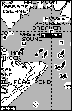
Comparing Maps
Representative and comparative road maps for the GM-100, G-III+,
and Street Pilot can be found on our website HERE.
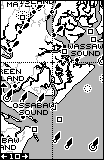
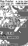
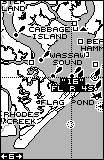
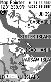
The water detail in the Lowrance GPS maps have historically been the best
available, as they are in MapCreate. The road detail in GM-100 "base
map" is quite similar to the road detail in the G-III+ and SP "base map".
While the MapCreate maps uploaded into the GM-100 are substantially more
detailed than the G-III+ base maps, they appear to be from an older database.
Some major roads more than 6 years old in the Atlanta area included in
the G-III+ are not shown, but most of the rural roads and streets ARE shown.
For a side-by-side comparison of the features of the G-III+ and GM-100
(Click HERE). Note: As with
ALL OTHER consumer model GPS receivers, ONLY maps produced by the
GPS vendor can be uploaded into the GM100. It is possible (with a
good bit of effort) to use OziExplorer to edit GM100 maps and to make minor
additions and changes to the GM100 maps. (see HERE.)
Note: Many of the rural roads and residential streets are not NAMED
on the maps even when they are "pointed to" using the cursor. Despite
these limitations, customers around the world will find the maps
are very useful, and since the maps come on CD ROM, Lowrance will
have the ability to furnish updates from time to time (as with City Streets).
In order for Garmin owners to obtain maps outside the Western Hemisphere,
they must purchase a second complete GPS receiver. The opportunity
for 3rd party map makers to step in and provide updated and specialty maps
for downloading into the GM-100 is being fulfilled by Ozi Explorer Ver.
3.73. Potentially, this is a great advantage. (See
OziMC examples HERE)
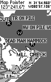
Comparing Nautical Nav Aids of
MapCreate and MapSource near Savannah, GA
(Placing
the cursor over the nav aid reveals additional information.)
GM-100
G-III+
GM-100
G-III+
GM-100
G-III+
 __
__
 __
__
MapCreate
The feature that makes the system 'revolutionary' is the new MapCreate
Software system (Win-95/98/NT 4.0 only). This system provides the
user with a CD ROM containing programs and a detailed ROAD MAP of the United
States and the rest of the world to a lesser extent. Lowrance advises
that these are RURAL roads and highways with only the major city
thoroughfares covered, not detailed city streets (as is available
with StreetAtlas5/6 software or the more expensive METROGUIDE CDs
of the Street Pilot.) MapCreate provided a fairly easy method
of selecting map "modules" and uploading them. No instructions were
furnished with our test copy of MapCreate, so there are probably more features
than we were able to discover.
The general procedure to use MapCreate is to select the "IMS WorldMap"
or the "IMS SmartMap" depending on where you live. The Help File states,
"The IMS WorldMap map series data was derived from 1:1,000,000 scale base
maps, and covers the entire world between latitudes 84 degrees south
to 84 degrees north, at a medium level of detail. The IMS SmartMap map
series was derived from 1:100,000 scale base maps, and covers the continental
U.S. and Hawaii at a high level of detail. The base maps for both the IMS
WorldMap and IMS SmartMap were supplied by U.S. government agencies and
conform to U.S. government accuracy standards corresponding to the map
scale." Examples of the MapCreate WorldMap can be found (HERE).
With the GPS unit connected and responding, zoom the map display to an
area of interest. Apply a "connect-the-dots" outline of a proposed map
and push "Create Map". The size (in MB) of the selected area will
be displayed. If less than 1.0MB, it will fit in one of the two map
partitions. If between 1.0 and 2.0MB, it will fit itself into both
map partitions. Highlight a map partition, and a simple push of the "Transfer
Map" button loads the map into the GPS, overwriting any map in the selected
partitions.
We found the MapCreate maps accurate and extremely detailed and up to date
in rural areas. About twenty users from all over the USA reported
generally accurate and up to date maps in their areas. A few
reports of omitted major highway segments surfaced, but overall,
users expressed great satisfaction with the detail and quality of the map
products. However, the City Streets CD (below) has corrected this
limitation.
City Streets
NOTE: NMEA must be turned off in order for the program to be installed.
The City Streets CD ($50US) contains all the maps of MapCreate plus the
addition of metropolitan streets. They are Tiger maps of an earlier
date than Street Atlas 5. For example, SA5 shows GA-400 south of
I-285, but MapCreate and City Streets do not. Other than the database
date, they are exactly like SA5 maps, and of course, not as detailed as
ETAK maps. As a rough estimate, City Streets contains more than 95%
of the streets and highways in the USA. It's possible, if less detail
is desired, to revert back to MapCreate maps. The CD also contains
GPS Data Manager (GDM16MS) and U.S. (marine) nav aids. See:
HERE for a comparison of City Streets to MapCreate, Street Atlas 5,
and Garmin Street Pilot maps . The CityStreets CD may contain an older
version (3.1 or 3.1a) of this program which fails to work properly with
some Lowrance units. The latest version is 3.1b.
Software Compatibility
For transferring data to and from scanned and DRG map software, The GM-100
is compatible with Ozi Explorer and Fugawi, except that Fugawi can only
upload tracks to Trail-1. For transferring data to and from vector
map software, the GM-100 is compatible with Precision Map 3s GPS Links
and Delorme's Street Atlas 5, 6, 7, provided the update file, deldmcgps2.exe,
is downloaded from Delorme
and run.
Lowrance Receivers are able to transfer data to and from Ron Hendersons
G7ToWin
also supports the GM-100. With G7ToWin, waypoints, tracks, routes,
and icons can be downloaded from the Lowrance receivers to an ASCII file
(for saving) or to all versions of Street Atlas. G7ToWin also provides
for uploading this data back into the GM-100 at a later time. Downloading
Screen Shots in the BMP format is another G7ToWin feature for the GM-100
and Eagle series.
Due to the cross-platform nature of G7ToWin, all data stored in Garmin
hand-held receivers (or archive files) of waypoints, routes, tracks, and
symbols can be uploaded to the Lowrance receivers.
It appears that the GM-100 is compatible with most moving map software
programs as far as real-time TRACKING is concerned. These include,
Precision Mapping 3, Street Atlas 5, 6, 7, MS AutoRoute 5,
Vista, NeverLost, NavMaster III, Fugawi, Ozi Explorer and others.
NMEA sentence outputs are: APB, GGA, GLL, GSA,
GSV, RMB, and RMC. (Please check our NMEA
Map Software Compatibility list before you buy software to work
with ANY low cost GPS unit. All "NMEA 183-capable" software will
not work with all "NMEA 183-capable" GPS receivers.)
Operational Considerations
First, a review of GM-100 features, operation and specifications.
The operation and form factor of the GM-100 is the same as the Eagle series,
but different from the Magellan and Garmin units. The GM-100 is about
2.25x1.65x6.75 inches, thicker and longer as compared with the G-III+.
The case is well made and sleek in appearance. The control buttons
are small and are about twice as hard to push as on the G-III+. The
power button is recessed to prevent accidental actuation. The
GM-100 is a comfortable fit in the hand. Unlike the G-III+,
one handed operation (while holding the GM-100 in your hand) is difficult
as the keyboard is located on the bottom of the unit below
the display. (Note: This is not a universally held opinion!)
The power/data connector is located at the top rear of the case.
The cable plug does not have a right angle cable mold, so the unit
cannot be placed flat on the dash when the cable is installed. A
connection for an external antenna is provided on the rear of the unit.
but the GM-100 cannot operate with commonly available external amplified
antennas as the GM-100 does not provide 5v power on the antenna port
The GM-100 locks on SV signals very quickly. From a "cold start",
after a 700 mile UPS trip, it locked on in 56 seconds. After
a 3 hour off time, the lock up time was 20 seconds.
If the unit is turned off and turned back on in
a few minutes ("warm start"), it locks typically in about
12 seconds. When we used the "search the sky" or autolocate
mode, the GM-100 took 6 minutes to lock.
(The G-III+ takes 16 seconds from a "warm" start situation,
52 seconds "cold start" and 105 seconds in "autolocate" in the same environment.)
Lowrance gives no specifications for start-up lock times in
the manual.
It is impressive that the GM-100 can lock regularly inside our homes.
No other GPS has been able to do this as consistently, including the most
sensitive Garmin receiver we tested, the G-12XL 4.00. Lowrance states
the GM-100's operating temperature range is -20C to +70C; however, Lowrance
publishes no specifications for the GM-100's position accuracy.
Lowrance tells us that the GM's specification for position accuracy
is 100 meters with SA (95% confidence). No accuracy
is specified exclusive of SA or for GM-100 accuracy with DGPS
signals. (The comparable G-III+ specs are 100 meters with SA,
15 meters exclusive of SA, and 5 meters with suitable one meter
DGPS signal. )
A comparison of the accuracy of data-logging of the Lowrance GM-100
and the Garmin G-III+ can be seen (HERE)
The GM-100 operates from 4 AA batteries or from external power in the
range of 5 to 35 volts DC (G-III+ spec is 10 to 32 VDC.)
External current draw is about 80ma light off and 140ma light on
with +12VDC power. On AA batteries, the draw averages
about 180ma light off and 280ma light on 100%.
). Battery life is not specified in the written specifications.
Lowrance engineering suggests about 13 hours (normal mode) and 20 hours
(power save mode). (Users report an average of about 8 to 9
hours in normal mode with alkaline AA cells.) The GM shuts
down when battery voltage reaches 4.0 volts. An optional NiMH
rechargeable battery pack is available with external
charger for about $100. This rechargeable
battery will be recharged INSIDE the GM-100 in two hours when the
unit is connected to the special external charger.
NOTE: NiCad AA batteries inside the GM-100 will NOT be
charged by the GM's internal charger. The battery compartment
in the rear of the GM-100 is covered by a flat plastic plate. When
installing the batteries, it can be a bit difficult to install the
battery cover as the batteries tend to want to "pop out" unless you hold
them. On a couple of occasions, the compartment cover popped
open and the batteries came out unexpectedly during testing. Though
the electronics compartment is rated submersible to 2 feet, the battery
compartment is not sealed or gasketed.
The GM-100 has a memory backup battery rated to maintain data memory for
ten years in the absence of AA cells. (G-III+ battery LIFE is rated
10 years, but the G-III+ battery will be depleted in about 3 months
if AA cells are removed.) DGPS signals in the standard RTCM-104
format are accepted. A setup screen permits selection of the I/O
combination needed by a particular application.
GM-100's Available
screen Displays and features
In the feature list below, we have indicated (+) or (-) whenever
we felt that the GM-100 feature was an improvement or not as good as the
G-III+'s feature list. The GM-100 has an impressive number
of features and displays that are useful. These include:
a) A round compass type display screen (NAV
mode) shows direction of travel (track) and has
an arrow pointing to the next way or routepoint. This
screen also provides the absolute and relative bearing to next
waypoint. Cross track error, distance, and ground speed,
is shown with reference to the next routepoint. As you approach
a waypoint or destination, a small circle appears on the compass screen
and moves to the center as you approach the waypoint. This
compass display includes a "highway track" display in the center
of the compass rose. The "highway track" display page in the G-III+
is a 3-D representation of the route ahead. Creating a Route is done
by "adding" them from the map while "panning and marking", much like with
the G-III+; however DELETING routpoints is much easier. When deleting
a route, the waypoints associated with it can also be deleted. With
the G-III+, deleting a route does not delete the waypoints associated with
it, but with the "Detete-by-Symbol" feature, they aren't difficult to eliminate.
+b) A moving
map (plotter) display is provided to plot your
course over ground. As with the G-III+,
the GM-100 plotter screen has a "base map" furnished
as an integral part of the unit's firmware. The Map display can have
additional Nav information at the bottom or none. Any waypoints
saved in the machine are displayed on the moving map page as
they come within range of the map scale selected.
This screen has pan and zoom with zoom in/zoom out
buttons on the keyboard and scales from .1 mile
to 2000 miles (or other units). The G-III+ provides scales
from 120 feet to 320 mi. (equivalent to GM-100 scales from 480 feet to
1280 miles since the GM-100 scale indicates full screen width).
A cursor control permits panning to various parts of the map plot.
Also the lat/long of the cursor crossing is shown on the display whenever
the cursor is active. The cursor is also used to place and erase
icons and waypoints. Pressing
the EXIT key removes the cursor from the screen.
c) The map (plotter) screen can be configured
as North up, Track up, or Course up.
d) The GM-100 provides a "grid lines" feature
with the plotter which can be turned on to aid
in estimating the relative locations of waypoints on
the plotter screen.
+e) The GM-100 provides three separate 3000 point
track trail logs. (G-III+ one 1800 point log which can be compressed
into (10) 250-point compressed logs). The track log may be
set to accumulate on a timed basis or distance-traveled basis. Track
resolution is NOT decreased when saved to one of the two saved-tracks as
with the G-III+.
-f) The GM-100 doesn't offer a third "automatic" option which plots
a track point when ever the projected track deviates more than a selectable
"resolution" distance as does the G-III+. (The G-III+ offers good
resolution over a longer track with fewer track points using the
automatic method.) As with the Eagle series, the GM-100 connects
un-related track plots together with unnecessary lines, which the Garmins
do not.
g) The GM-100 provides a set of twenty-eight "icons" which
can be placed to identify a waypoint. These include an anchor,
gas pump, airplane, house, fish, etc.
Icons can be easily placed and removed using the cursor control.
h) The GM-100 has an impressive array of "WINDOWS"
that can be selected as an alternate display. These windows
displays include satellite status, NAV 1 & 2 screens,
Map 1, 2, & 3 screens, and Groups A thru J. Map #1 is a full
screen while #2 & #3 are 3/4 screens with user-selectable digital readout
boxes. Thus the maps and position data show at the same time
with only a slight loss of map size as compared to the programmable window
groups. The Groups include, clock, DGPS status,
UP/Down timer, ETA, ETE, BRG, DST, TRK, VMG, Position, GS,
CDI display, and other data in a variety of fixed arrangements.
One screen shows simultaneously your lat/long as well as your UTM position.
+i) The GM-100 has an ALARM CLOCK function. Unfortunately,
the GM-100 must be turned on for it to operate. This
feature will be expensive to use due to battery drain, but the GM
does have an audio alarm and some may well find this a useful feature.
No NMEA message is provided to externally enunciate an alarm.
j) The GM-100 has two TIMER functions available.
A "count down timer" can be set to some numbers of hours,
minutes, and seconds. When the timer goes to zero, an
alarm is displayed on the screen. There is no audible
alarm. A "count up" timer can be reset to zero and started.
It can then be viewed to determine elapsed time.
-k) Battery drain cannot be decreased when using the above alarms
by selecting the Simulator Mode as with the Garmins. AA battery life
in the GM-100 is about half that of the G-III+.
+l) The GM-100 has a number of Default Window Groups which display
a number of parameters. These windows can be completely configured
by the user. The GM-100 can store up to 750 waypoints.
(G-III+ = 500)
m) Two pushes of the WPT key will automatically save your current
position as the next waypoint number in the waypoint list.
Putting in up to 8-character waypoint names (the G-III+ only allows
6) requires a modestly involved trip through the menu system. Naming
is not as easy as in the G-III+, but is improved over the Eagle series
where you had to edit out a long GPS-created name.
n) A feature permits you to move all information about
a waypoint from one waypoint number to another.
+o) The GM-100 permits waypoints to be identified on the map
plotter screen in a number of ways (or not at all). They
may be shown as a "number in a box", or "named" and with or
without an icon.
+p) The GM-100 provides the usual ROUTE facility with
a few additions. 99 different routes are
provided with 99 waypoints each. One nice addition
permits automatic startup up in the MIDDLE of a
route and the GM-100 will select the nearest waypoint
in the route in the direction of travel as the starting point.
q) Editing waypoints and routes in the GM-100 is a bit
more tedious than with the G-III+. There are more features
provided for editing waypoints and some (like giving the range and
bearing between waypoints while editing routes) seem quite useful.
r) The GM-100 provides a "Go to Cursor" feature.
The cursor is placed on the plotter screen at
the desired destination location. Then the
"Go to Cursor" mode is selected via menus.
+s) The GM-100 can operate with any one of 191 different map
datums by selecting the proper map datum from the GM-100's
map datum list. (G-III+ has 107 plus user-grid
datum). The GM-100 does have a Position Correction
Factor (PCF feature) to permit input for offsets of an odd
map datum. UTM is included.
-t) The GM-100 does NOT have a user-grid
datum capability which inputs scale factor plus false northing and
false easting as with most Garmins.
u) The GM-100 provides a Position Pinning feature which
can be set ON or OFF. This will prevent the "wandering" position
caused by SA when you are stopped. Although we don't use this
feature in our evaluations due a possible false conclusion about the accuracy
of the GPS receiver, others may find it useful and helpful.
v) A simulator feature provides display of simulated
motion and simultaneously outputs simulated tracking data
to your computer for test of mapping software, data gathering simulations
and such. Unlike the G-III, using simulator mode to input parameter
data does not reduce battery drain.
w) A screen back lighting timer permits setting the
back light to 0, 15, 60, 120, 240 seconds or continuous.
The screen back lighting is continuous (when selected) on battery power.The
blue-green backlit display is easy to read at night and is an improvement
on the Eagle series green screens. Screen contrast is also
adjustable on the setup screen.
x) A satellite status page comes up when
you first turn the unit on. It shows a "compass"
display of the closest 12 satellites' numbers ( whether in view or not)
along with signal strength bars for each satellite. The
signal-strength bars are hollow if the GPS has found the SV and is
not yet locked and changes to solid black when lock is made
to each satellite in turn. On the polar plot,
SV numbers are black on white when not locked and white on
black when locked. SV bars are listed as to the closest and
not numerically as with the Garmins. We like the fact that the GM-100
(unlike other Lowrance products) does not force the user to press "enter"
to get past the "don't use this instrument as your sole means of navigation"
warning.
+y) PROJECT A WAYPOINT is available to permit a user
to input a new waypoint location by entering a bearing and distance to
a NEW waypoint with reference to an already existing waypoint. The
GM-100 has POSITION CORRECTION FACTOR which can be useful with unusual
or uncalibrated maps. The user can input an PCF (fudge factor) to
make a known position match up with a paper map.
z) GM-100 can operate automatically with Starlink and
Magnavox DGPS receivers to automatically select and display the bit rate
and frequency. Note: NMEA data cannot be sent to the GM while
this mode is in operation.
aa) Waypoint AVERAGING is provided in the GM-100. This allows automatic
entry of a more accurate fixed position when time permits.
+bb) The GM-100 has an arrival alarm, CDI (off track) alarm,
and an Anchor alarm. These can be quite useful.
A Sunrise/set, Moonrise/set calculator is included.
Frequently available features
not found in the GM-100
a) The DATE display is NOT automatically updated when
SV lock occurs. The user must set the local date. Also,
there is no "offset from UTC" setting. The user must
manually set the local time correct to the hour,
and minute to get the offset correct.
b) We found that the time display on our
sample of the GM was almost exactly two seconds slow
with respect to UTC from WWV. The G-III+ display by
comparison was about one-half second slow. The GM has no specification
on accuracy of the time display.
Subjective Observations
of Performance
We have been out testing the GM-100 on the road and in the field.
The GM-100 has worked without a problem that either of us could find.
We had no trouble using MapCreate to upload the detailed maps we needed.
We compared it with the G-III+ for lock times and the ability to
hold lock under various situations. We were very impressed
with the GM-100. The GM receiver is a superior unit and performed
on a par (and sometimes better) as compared with the Garmin G-III+ (except
the GM cannot use common external AMPLIFIED antennas).
We tried the GM-100 and the G-III+ on the
car's dash.
Performance was essentially equal with both units BUT we felt the receiver
in our GM-100 was a bit quicker to lock than the G-III+ or the G-12XL 4.00
(the most sensitive Garmin receiver we have) and the GM-100 would occasionally
achieve lock (inside a house) when the Garmins did not. We
did not note any differences in lock capability out of doors. The
simultaneous computer display tracks were essentially identical throughout
our testing. The GM-100 (and the G-III+) quickly
responded to changes in direction and speed. At about 4mph,
both units would complete a change of direction in about 15 feet.
The GM-100 (and the G-III+) laid down smooth tracks on our
highway maps during all tests.
No gaps, jumps, etc., were observed in the tracks except between unrelated
tracks as described above.
These are the major features we have observed in working with the GM-100.
It is a well built GPS receiver and at about US$375,
offers good value for the money when the uploadable maps are considered.
We liked the user programmable screens which give
users an almost totally customized display capability.
We liked the option of having digital displays of bearing,
distance and other parameters on the map plot screen. We also
liked the fact that the user can change the contents of these
digital fields on the plot display.
The GM-100 gave quick lock and quality performance under all tested
conditions. The GM-100 is rated submersible to two feet of water
for one minute. Note: The battery compartment is NOT gasketed
or sealed so it should be flushed and dried out immediately if the unit
is submersed. Operating temperature range is -20C to +70C..
Storage temperature range is -20C (-4F) to +75C
(+167F). The GM-100 has a one year manufacturer's
limited warranty. There are a number of additional features
in the GM-100 as compared with the G-III+ and as a result, there
are more menus to contend with. At first, these additional
menus were a problem, but we quickly learned how
they worked. (We sometimes had difficulty finding features due to
the extensive menu system. The menus could be organized a bit better
for ease of use.) The size of the GM-100 and G-III+ are
about the same (GM-100 a bit larger) but with slightly different
form factors. We rate the G-III slightly more of a "shirt pocket"
item. The 8.5 hour battery life of the GM-100 compared with
the 18 hour battery life on the G-III+ might make the purchase of the rechargeable
battery pack worth while.
We made these tests using Toshiba laptop
computers running various moving map software.
The two GPS units were operated simultaneously with the GM-100
on the dash in front of the driver and with the G-III+ on the right
side of the dash in front of the passenger. The units were
interchanged and no appreciable differences in performance
were noted. The laptops and GPS receivers were positioned so
both displays could be watched simultaneously and then we drove over a
course of perhaps 30 miles and evaluated the relative performance of
the GPS equipment by observations including the GPS "cookie
trails' on the moving map displays.
Manual, Specifications
and Technical Support
The manual was well written and complete except for an index
and technical specifications for the GM-100. The GM-100 "specifications"
in the catalog are a feature list and give no quantification as
to battery drain, position accuracy, lock speeds, speed
accuracy, operating temperature range, etc. Most
of the specification information contained in this review was provided
by private correspondence with representatives of Lowrance Engineering.
Users have told us that service for the GM-100 is fast and
reasonably priced. The major complaint is that the GM-100 is
in high demand and difficult to find for purchase -which is an indication
of the level of demand for this receiver..
We appreciate the assistance of Lowrance Engineering personnel with
questions and specification data not available in the manual.
User Complaints
Users had generally favorable remarks with respect to the GM-100.
Here are a few items which were repeated.
1) Screen scratches easily and needs protection.
2) Battery compartment cover is flimsy and pops
off unexpectedly at times. Batteries are clumsy to install.
3) MapCreate's maps often seem to either lack detail
or are too cluttered depending on zoom level. Zoom should maintain
a relatively constant level of detail on the screen. (I concur,
but think this will be corrected in future updates.)
4) No power provision for use with commonly available
external antennas.
5) Case is too "fat" for shirt pocket convenience
and screen cannot be rotated.
OVERALL, the respondents had a very positive response and were especially
pleased with the downloadable map capabilities and general feature arrangement
provided with the GM-100. Good quality of technical support
was mentioned by several users.
If anyone has any additions, questions, suggestions,
error corrections or other comments, please feel free to Email:
GOOD NAVIGATING