We are delighted that Lowrance is now delivering the iFinder.
Lowrance GM-100 was the first GPS receiver with user uploadable maps.
The iFinder is the first consumer model handheld update from Lowrance since
the pace setting GM-100. We received a Lowrance iFinder, a
copy of MapCreate 6 (USA maps), an external antenna, and a power
cable for the iFinder. The "street price" of the iFinder plus
a copy of MapCreate 6 is about $365. Check latest prices HERE.
The iFinder reviewed had firmware revision 1.2.1 dated February 2002. (Later
software is available but not tested by us.) A few of the unique features
of the iFinder are: a) Will accept either MMC or SDC memory cards
up to 256MB, b) has optional color case faces, c) holds routes,
tracks, waypoints AND maps in the removable memory module, d) an
"easy" and "advanced" user interface makes for easy initial use while providing
advanced capabilities for more experienced users, e) 1000 waypoints,
1000 event marker icons, 100 routes, TEN savable trail (tracklog)
points with up to 9,999 points per trail (MOST of any handheld GPS I know
of. If you want MORE points, just carry more MMC cards with
you.). f) 37 zoom ranges from 0.05 to 4000 miles, All waypoints,
routes and tracks are downloaded by the removable memory module (No serial
port is currently provided but a USB or parallel port can be used for loading/reading
the MMC cartridge depending on model selected.).
There are four iFinder configurations, each including the same
GPS receiver but different accessories. a) iFinder (basic) just has
the GPS receiver and manual and nothing else. b) iFinder Plus includes
iFinder/Manual/MapCreate 6 and a 16MByte MMC card and card reader, c) iFinder
Atlantis is a marine model and includes a 16 Meg MMC card with high detail
mapping of the continental USA coastline and d) iFinder Express is designed
for inland USA use and has a 32meg MMC card loaded with much of the SEARCHABLE
POI database.
MapCreate Version 6
MC6 is Lowrance's latest street map
program designed expressly for the iFinder. It provides the ability
for the user to select map sections from the MC6 map library and the program
can "clip" and upload these selected map sections to iFinder. See
HERE
for
an example of the map selection process. Note: Map CREATION
is a bit strong for what MC6 does. MC6 allows you to select areas
of maps provided by the MC6 CDROMs and upload these selected sections to
your iFinder. MC6 presently is compatible ONLY with Lowrance models:
X-15, LMS-24D, LMS-240, GlobalMap 2400, GlobalMap 3000,
LCX-15, and LCX-16 and iFinder.
The MapCreate 6 maps come on two CDROMS and appear to be approximately
up to date when compared with Delorme StreetAtlas 9 and MetroGuide USA.
As always, there are a few errors, but overall the maps are
quite satisfactory and seem up to date within about 3 years in our area.
The most recent restaurant listed in my area in the POI listings is about
5 years old. MapCreate 6 has the ability for a user to outline rectangles
of area using a mouse and then have these map sections configured for upload
to the MMC removable memory module. The iFinder is unique among handhelds
in that the serial port cannot be used to load maps into the GPS.
Instead, data is transferred by removing the memory module and placing
it into a MMC to PCMCIA adapter or into the MMC to USB adapter
(parallel port adapter available) and copying the maps to the removable
memory module. While the iFinder has a NMEA setting in setup,
the iFinder and MC6 have no current ability to load maps via the accessory
serial cable.. (Note: When installing MC6, if it asks
for disk 3, it really is asking for disk 2.)
We found MC6 generally easy to use.
The PC help files are useful, but not indexed as completely as I
would like. The manual for MC6 and iFinder appear to have all of
the information on both systems, but I did have to phone tech support
for help in actually loading the maps into the MMC memory chip. This
was because there is no option in MC6 offering: "Load Maps to Memory Cartridge".
Instead, when you have created the map file, (the manual will
tell you), you just use Windows Explorer (or similar) to copy the map file
to the MMC memory reader/writer storage device attached to the USB port.
Note: you MUST have a USB port on your computer to be able to load
maps or otherwise communicate with the iFinder. There is NO serial
connection capability for this service presently available for iFinder.
MC6 has some nice features, but it is not as easy to use as
the "connect the dots" scheme used in the original MC. MC6 does offer
a nice capability for building "highway corridors". These allow the
ability to store high road detail along a narrow path traversed by
a highway. This is quite economical of map memory and easy to use.
Random shaped areas around cities can be enclosed by a series of rectangles
and filled in by the addition of highway corridors as needed.
We were not able to download high detail map pictures from the iFinder
for our review. As a substitute, Please see representative
screen shots from our computer display HERE.
(Download approx. 1 Meg.) Representative and comparative road maps
for the older GM-100, G-III+, and Street Pilot can be
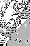
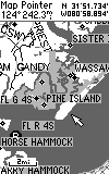
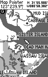
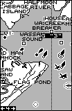
found on our website HERE. The water detail in the Lowrance
GPS maps have historically been the best available, as they are in MapCreate
6. The road detail in iFinder "base map" is quite similar to the
road detail in the latest Magellan and Garmin base maps. The basemap
includes political boundary maps of the world, but the detail is
essentially the outline of countries with rivers and lakes shown.
Note: As with ALL OTHER consumer model GPS receivers, ONLY
maps produced by the GPS vendor can be uploaded into the iFinder.
OziExplorer CANNOT edit MC6 maps.
Note: Many of the rural roads and residential streets are not NAMED
on the maps even when they are "pointed to" using the cursor. Despite
these limitations, users will find the maps are very useful, and
since the maps come on CD ROM, Lowrance will have the ability to
furnish updates from time to time (as with City Streets).
Comparing Nautical Nav Aids of
MapCreate and MapSource near Savannah, GA
(Placing
the cursor over the nav aid reveals additional information.)
GM-100
G-III+
GM-100
G-III+
GM-100
G-III+
 __
__
 __
__
We found the MapCreate maps accurate and extremely detailed and up
to date in rural and city areas. Users from around the USA also report
generally accurate and up to date maps in their areas. In a
review of POI (Points of Interest) shows that more than a few business
are out of place by significant distances. While POI location errors
are not unusual, these errors seemed to occur at a higher rate (in
areas we know well) than in other recent map systems we have
reviewed. This error rate likely varies widely with location as has
been our experience with all other POI lists.
While MC6 operates without problems on a high speed computer with
a large RAM memory, users need to consider their computer's speed
and RAM memory when using MC6 to "create" maps. While Lowrance states
rather modest requirements for the PC computer to be used for "creating"
maps using MC6, we are going to suggest another criteria. Using
the ORIGINAL CDROM of MC6 (ver 6.0.1), our criteria is: Your
computer MUST have RAM at least FIVE times as large as any "group of map
sections" you select for "creation". In a BETA software version I
evaluated in May 2002, Lowrance had made some dramatic improvements.
In this new version, my criteria is: Your computer MUST have
RAM at least TWO times as large as any "group of map sections" you select.
In fact, you can use virtual memory up to about 50% of your RAM size
without slowing down dramatically. (Note: With MC6, it
is quite possible to make up a number of small map sections and separately
load them into the GPS memory module. Unlike Garmin units,
map sections ARE NOT automatically erased when you load a new map section.
This workaround is recommended by Lowrance for those with computers with
RAM not meeting the above criteria.) Greg Parrish gives us his recent
experiences with loading maps to his 256meg SD cartridge HERE.
Below are shown compute times for MC6 for various map sizes on a
variety of computers using the ORIGINAL ver 1.0.6 software.
Computer Speed RAM
MC6 map size Elapsed time to create map
1.7Ghz
512meg 120.5megs
14 minutes
1.0Ghz
128meg 120.5megs
18 hours and did not finish
1.7Ghz
512meg 62.5
megs
6 minutes
1.0Ghz
128meg 62.5
megs
18 hours and did not finish
1.7Ghz
512meg 32
megs
3 minutes
1.0Ghz
128meg 32.2
megs
35 minutes
366Mhz
96megs 32.2
megs
>2 hours
1.0Ghz
128meg 16.4
meg
< 5 minutes
366Mhz
96megs 16.4
megs
8 minutes
Using the NEW BETA SOFTWARE, as long as the MC6 map size is
less than about half the size of RAM in your PC, execution times
will be in the range of minutes as long as you have a computer CPU speed
in the several hundred MHz range. If you exceed this guideline,
your map may take (literally) days to complete if it does not hang your
computer. In the old (ver 6.0.1) MC6, there was no guidance
as to how large a map the user had selected. In the new BETA software,
a map size estimator is available so you can verify before starting the
map create process if your map is going to work reasonably according to
the above guidelines.
Software Compatibility
Routes, Tracks and Waypoints can be transferred to and from the iFinder
using MC6. This is done by interchanging the MMC memory cartridge
between the memory card reader/writer and the GPS. (No serial port
capability currently is available for this functionality.) No current
capability exists for electronically transferring data to and from scanned
and DRG map software as no third party software is currently available
(as far as we know) which is able to read the MMC data in Lowrance format..
iFinder does have NMEA output capability and a companion NMEA data+Power
cable is now available from LEI parts for US$24. This cable is a
Y cable assembly with iFinder connector and cigar plug connector and the
third end is bare wires. Information is provided to allow installation
of a DB9 connector for your computer connection. (We do not have
this cable and so cannot comment on operations with it.)
iFinder GPS Operational Considerations
First, a review of iFinder features, operation and specifications.
The operation and form factor of the iFinder is a neat "flat" and
pocket sized form factor similar to the Garmin eMap. iFinder
size is about 5.6in H, 2.5in W and 0.9in D (142 x 65 x 25 mm). Weight
is 7.7 oz (220gm) with batteries. One MMC slot is provided and iFinder
currently supports up to 128meg memory. GPS receiver is 12 channel
with good sensitivity. iFinder can support up to 1000 waypoints and
1000 event marker icons. There are 42 icons to select from.
iFinder has the EXCEPTIONAL capability to save 10 track (trails) with up
to 9,999 points per track in its REMOVABLE memory. So if you need
even more tracklog points, you can just change out the memory card
and continue on. iFinder can also support up to 100 routes in memory.
Tracklog points and Route capability is about 5 times larger than
in competitive units.
The power button is slightly recessed to prevent accidental actuation.
This works well. The iFinder is a comfortable fit
in the hand. iFinder has operating buttons located low on the front
of the case. One handed operation (while holding the iFinder
in your hand) is difficult (for me) as the keyboard is located on the bottom
of the unit below the display. (Note: This
is not a universally held opinion and other users like the bottom position
best!) The power connector is located at the bottom
of the case. Note: The iFinder connector is similar to the
eMap/eTrex connector, but the pinouts are different. Plugging
an Garmin cable onto the iFinder and plugging in 12 volts may well damage
the iFinder.
A connection for an external antenna is provided on the rear of the unit.
but the iFinder cannot operate with commonly available external amplified
antennas as the iFinder does not provide power on the antenna port.
However, the iFinder DOES have an external antenna port and works
with the passive Lowrance external antenna. This antenna works fine
in automobiles, but does not offer the gain provided by the 20db
amplifiers in other models. As a result, the external antenna
works fine on boats, cars where it has a clear view. It works
less well (in comparison with amplified external antennas) in woods where
foliage attenuates the signal.
The iFinder locks on SV signals very quickly. From a "cold start",
after a 700 mile UPS trip, it locked on in 47 seconds. After
a 4 hour off time, the lock up time was about 20
seconds. If the unit is turned off and turned
back on in a few minutes ("warm start"), it locks typically
in about 15 seconds. When we used the "search the sky"
or autolocate mode, the iFinder took 4 minutes to
lock. Lowrance gives no specifications for start-up lock times
in the manual.
Lowrance states the iFinder's operating temperature range is -20C to +70C;
however, Lowrance publishes no specifications for iFinder position
accuracy. Our experiments showed the iFinder on a par with most other
consumer handheld GPS models.
The iFinder operates from 2 AA batteries or from external power in the
range of 2.75 to 3.25 volts DC. For external power
operation, iFinder has an optional power cord with a regulator rated
to operate from 10 to 32 volts. Battery current draw
is about 180ma light off and 230ma light on 100%. Battery
life is not specified in the written specifications. Lowrance
engineering suggests about 13 hours (normal mode) and 20 hours (power save
mode). (Users report an average of about 8 to 9 hours in normal
mode with alkaline AA cells and we got approximately 8 hours of continuous
use with light off.) The iFinder shuts down when battery voltage
reaches about 2.0 volts. Lowrance recommends NiMH batteries
but states that NiCaD batteries should NOT be used. The iFinder has
spring contacts on both ends of the batteries and iFinder demonstrated
NO problem when operated in high vibration as far as batteries losing contact
is concerned.
The battery compartment in the rear of the iFinder is covered by a plastic
cover. The cover snaps securely to the case and no problems were
noted in the battery cover "popping off" on its own as was a problem with
the earlier GM-100. The Ifinder battery door is NOT waterproof and
the electronics compartment is not sealed from the battery compartment
as was the GM-100. However, an "aquabag" comes with iFinder and we
recommend using it to keep water from harming the device.
The iFinder uses FLASH memory for data memory and uses a capacitor to maintain
memory for orbital parameters during a battery change. If batteries
are left out of the unit a lithium memory support battery will maintain
user data "for as long as 10 years". We found that removing batteries
for more than a few minutes did cause longer lock times on power up apparently
due to loss of satellite orbital parameters.
iFinder's Available screen
Displays and features
Note: Photos below were taken using
a program furnished by Lowrance which could not be configured to show the
high detailed MC6 maps. The MC6 maps were indeed high resolution
and accuracy was very good. There are three navigation screens: Map
Screen, Compass Screen, and Position screen plus a satellite
screen showing which GPS satellites are in view and locked.
The other available screens are used for function setup and are shown on
the above page.
a) A round compass
type display screen (NAV mode) shows direction of
travel (track) and has an arrow pointing to the next way or
routepoint. This screen also provides the
absolute and relative bearing to next waypoint. Cross track error,
distance, and ground speed, is shown with reference to the
next routepoint. As you approach a waypoint or destination,
a small circle appears on the compass screen and moves to the center
as you approach the waypoint. This compass display includes
a "highway track" display in the center of the compass rose. The
"highway track" display page in the G-III+ is a 3-D representation of the
route ahead. Creating a Route is done by "adding" them from the map
while "panning and marking".
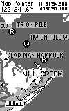
b) A moving map (plotter) display is provided
to plot your course over ground.
The iFinder plotter screen has a "base map" (Shown
HERE) furnished as an integral part of the unit's firmware. The
Map display can have additional Nav information at the bottom or none.
Any waypoints saved in the unit are displayed on the
moving map page as they come within range of the map scale
selected. This screen has pan and zoom with zoom
in/zoom out buttons on the keyboard and scales
from .05 mile to 4000 miles (or other units). A
cursor control permits panning to various parts of the map plot.
Also the lat/long of the cursor crossing is shown on the display whenever
the cursor is active. The cursor is also used to place and erase
icons and waypoints. Pressing
the EXIT key removes the cursor from the screen.
c) The map (plotter) screen can be configured
as North up, Track up, or Course up by user
selection.
d) The iFinder includes two user interface modes. An EASY MODE
is provided which includes most common user setup functions. An ADVANCED
MODE provides access to setup features of interest to more technical users.
We found both easy to use, but the proliferation of menus in the
advanced mode takes some familiarization time.
+e) A real advancement provided by the iFinder is the capability
for storage of up to TEN separate tracklogs with up to 9999 trackpoints
in each. These tracklog points are stored in the removable memory.
Therefore, if you need even MORE tracklogs on a particular expedition,
it is a simple matter to bring along additional SD or MMC cartridges and
swap them as needed. Track resolution is NOT decreased when saved
to one of the ten saved tracks as with many other GPS receivers.
f) iFinder offers AUTOMATIC, TIMED, and DISTANCE options for
dropping tracklog points.
g) The iFinder provides a set of 42 "icons" which can
be placed to identify a waypoint. These include an anchor,
gas pump, airplane, house, fish, etc.
Icons can be easily placed and removed using the cursor control.
h) The iFinder has just four navigation displays.
These are: Satellite Screen, Map Screen, Position Screen, and
Compass Screen. This is in substantial contrast to the GM-100 which
had many more. However, we feel that the iFinder's four screens
provide the basics necessary for navigation. We do feel that
the lack of a cross track error screen makes the iFinder less useful for
marine or glider applications. The Position screen simultaneously
displays Lon/Lat and UTM coordinates which will be a boon to those needing
to convert between these two systems.
Each of the three iFinder navigation screens has the ability to display
users selectable data. These include: Track, Bearing, Course,
Distance Speed, Altitude, Closing Speed, Travel time, Arrival
Time, Local Time, Date, and Off Course.
i) The iFinder has an ALARM CLOCK function. Unfortunately,
the iFinder must be turned on for it to operate. This
feature will be expensive to use due to battery drain, but the iFinder
does have an audio alarm and some may well find this a useful feature.
j) The iFinder has two TIMER functions available.
A "count down timer" can be set to some numbers of hours,
minutes, and seconds. When the timer goes to zero, an
alarm is displayed on the screen. There is no audible
alarm. A "count up" timer can be reset to zero and started.
It can then be viewed to determine elapsed time.
k) Battery drain can be decreased when using the above alarms by
selecting the Simulator Mode.
+l) The iFinder can store up to 1000 waypoints and 1000 event marker
icons. This is more than in most competitive units.
m) Two pushes of the ENT key will automatically save your current
position as the next waypoint number in the waypoint list.
(Other waypoint save options are: cursor position, entered position,
averaged position, and projected position.) Naming
is not as easy as in other GPSRs. Putting in up to 20 character
waypoint names requires a modestly involved trip through the menu
system. (Long waypoint names will take up the entire screen width.)
It can take eight or more button pushes to get to the name and the sequence
is not obvious to new users.
n) Information which can be edited in waypoint data include:
lon/lat, altitude, symbol, and name.
o) The iFinder in concert with MC6 offers a very complete SEARCH
capability. The user can search for addresses, highway exit,
streets, cities and etc. Included as sub categories are attractions,
emerg/govt, entertainment, fishing, hunting, lodging, marine, restaurants,
services, shopping, sports, transportation, public lands (parks)
and water.
+p) The iFinder provides the usual ROUTE facility
with a few additions. 99 different routes
are provided with 99 waypoints each. One nice addition
permits automatic startup up in the MIDDLE of a
route and the iFinder will select the nearest waypoint
in the route in the direction of travel as the starting point.
q) Editing routes in the iFinder is possible,
but a bit more tedious than with other units.
r) The iFinder provides a "Go to Cursor"
feature. The cursor is placed on the plotter
screen at the desired destination location.
Then the "Go to Cursor" mode is selected via
menus.
s) The iFinder can operate with any one of 15 different
grid systems. For those who count datums, there are 193
different map datums available in iFinder. The iFinder
also has have a Position Correction Factor (PCF feature) to
permit Northing and Easting offsets (only) for an odd map datum.
UTM is included. Another interesting feature is the ability
to do lon/lat to Loran C position conversions.
t) The iFinder does NOT have a user
grid datum capability which inputs scale factor plus false Northing
and false Easting with grid data as with most Garmins. It DOES
have MGRS and Loran TD conversion capability.
u) iFinder has a neat "context help" drop down which
"drops" when you stop on a menu entry for a few seconds. The context
help information tells the user what the menu item is for in a few words.
This is VERY useful when you are getting started.
v) A simulator feature provides display of simulated
motion for test of mapping software, data gathering simulations and
such. The user can adjust starting position and track and speed and
can steer using the rocker switch.
w) A screen back lighting timer permits setting the
back light to 5, 10, 15, 20, 30, 60, 120, 240 seconds
or continuous. The screen back lighting is continuous (when selected)
on battery power. Brightness and contrast are adjustable. The
blue-green backlit display is easy to read at night.
Backlighting is turned ON/OFF by a momentary push of the power switch.
x) When you first turn the unit on
it displays the usual logos and legal notices and after a timeout it shows
the last NAV screen in use when power was turned off. A Satellite
display screen is available by pressing the PAGES button. The Satellite
screen shows a "compass" display of the closest 12 satellites' numbers
( whether in view or not) along with signal strength bars for each
satellite. The signal strength bars are hollow if the
GPS has found the SV and is not yet locked and changes to gray when
a satellite is found and then to solid black when lock is made
to each satellite in turn. On the polar plot,
SV numbers are shown in relative positions corresponding to the direction
of satellites. We like the fact that the iFinder (like the GM-100)
does not force the user to press "enter" to get past the "don't use this
instrument as your sole means of navigation" warning.
y) PROJECT A WAYPOINT is available to permit a user to
input a new waypoint location by entering a bearing and distance to a NEW
waypoint with reference to an already existing waypoint.
z) iFinder provides and Up Timer, Down Timer, Sun/Moon
calculator, Trip Calculator and Alarm Clock in its UTILITIES group.
aa) Waypoint AVERAGING is provided in the iFinder. This allows automatic
calculation of a more accurate fixed position when time permits and the
unit can be left in a fixed position..
bb) The iFinder has an arrival alarm, Off Course alarm,
and an Anchor alarm. These can be quite useful. They
can also be quite irritating as they pop up and get in the way of other
displays and can be quite difficult to get to "go away".
A Sunrise/set, Moonrise/set calculator is included.
Subjective Observations
of Performance
We have been out testing the iFinder on the road and in the field.
The iFinder has worked without a problem that either of us could find.
We initially had difficulties figuring out how to "create" and load large
maps into the MMC card. The updated (beta) software which is soon
to become available as an update on the Lowrance website made things much
easier to use. The MMC reader/writer USB is treated as another disk
drive on your computer. Maps are created for upload and copied to
the MMC modular memory in just a few seconds.
The iFinder seems to us to be a direct competitor of the eMap.
However, it provides improved functionality at similar prices.
For instance, the iFinder offers WAAS whereas the eMap does not.
In addition, the THREE navigation screens (plus satellite screen)
makes it much more useful than eMap with its single map screen (plus satellite
screen). We feel the major drawback of iFinder relative to eMap is
iFinder's lack of RS-232 serial port support (at this time).
We like the fact that waypoints, tracks and routes are also stored
in the MMC module. This feature provides iFinders means of
getting waypoints, routes and tracks to the user's PC as there is
currently no serial port support available to upload/download waypoints,
routes and tracks to/from the GPS. Instead, the MMC module
is removed from the iFinder and inserted into the MMC reader. Then
the routes, tracks and waypoints can be downloaded into the MC6 mapping
program. Note: No third party software is currently (5/20/02)
available that is able to read these files. It will be interesting
to note if users accept this new mode of data interchange between GPS and
PC. Lowrance has left its option to add serial port support for upload/download
of routes, tracks and waypoints if users feel they need it.
We compared iFinder with competitive products for lock times and
the ability to hold lock under various situations. We were
impressed with the iFinder. The receiver is a quality unit
and performed on a par (and sometimes better) as compared with other units
(except the iFinder cannot use common external AMPLIFIED antennas).
Instead of amplified external antenna capability, Lowrance furnishes
an optional unpowered patch type antenna with about a 1.5 meter cable which
is used to remote the antenna. This appeared to work well,
but it did have lower sensitivity than GPSRs equipped with amplified external
antennas.
iFinder at a street price of about $365 including a copy of MC6,
offers good value for the money when the uploadable maps are considered.
We liked the user programmable screens which give
users an almost totally customized display capability.
We liked the option of having digital displays of bearing,
distance, cross track error and other parameters on the map plot screen.
We also liked the fact that the user can change the contents
of these digital fields on the plot display.
The iFinder gave quick lock and quality performance under all tested
conditions. The iFinder is rated IPX2 which means rain resistant.
It is not waterproof and will leak if submerged. Note:
The unit is NOT gasketed or sealed so it should be flushed and dried out
immediately if the unit is submersed. Use of the provided AquaBag
is encouraged in wet conditions. Operating temperature range is -20C
to +70C.. Storage temperature range is -20C
(-4F) to +75C (+167F). The iFinder has a one year
manufacturer's limited warranty.
There are many features and optional settings in iFinder. We sometimes
had difficulty finding features due to the extensive menu system.
(The menus could be organized a bit better for ease of use and the table
of contents in the manual is incomplete. No INDEX is provided in
the manual.) The size of the iFinder is similar to the eMap,
but slightly thicker. We rate the eMap slightly more of a "shirt
pocket" item due to its one ounce lighter weight and to eMap being slightly
thinner. The 8 to 9 hour battery life of the iFinder gives it a slight
disadvantage compared to similar units.
Manual, Specifications
and Technical Support
The manuals for both iFinder and MC6 were well written and complete
except for no index and the technical specifications which
were incomplete. The iFinder "specifications" in the
catalog are a feature list and give no quantification as to battery
drain, position accuracy, lock speeds, speed accuracy,
operating temperature range, etc. This has been typical
with Lowrance in other models. Most of the specification information
contained in this review was provided by private correspondence with representatives
of Lowrance Engineering.
We appreciate the assistance of Lowrance Engineering personnel with
questions and specification data not available in the manual.
Users Liked these features
1) Optional range rings on display helped to quickly access distance
to object and waypoints on the map.
2) Large screen (with lower resolution ) lettering made screen easier
to read than some others. (We agree!)
3) Good map accuracy of reasonably priced maps.
4) 128meg map memory
5) Lots of user adjustable features.
6) iFinder automatically sets the date. (unlike the GM-100).
User Complaints
Users had generally favorable remarks with respect to the iFinder.
Here are a few problem items which were repeated.
1) MC6 will not build large
maps. (Fixed in MC6 beta update furnished for this review.)
2) No serial port for waypoint, route, and
track upload/download and having to remove the MMC module is clumsy and
time consuming.
3) Cannot get the elevation or time of creation
when waypoints are downloaded.
4) Cannot download TRACKS to MC6.
(Hopefully this will be fixed soon.)
5) No power provision for use with commonly
available external antennas.
6) Only three NAV screens make use for marine
navigation a problem.
OVERALL, the respondents had positive responses
Good quality of technical support was mentioned by several users.
SPECIFIC QUESTIONS ANSWERED:
If you have questions not answered by the review, send them
to us and we will answer them and post the generally useful information
here.
1) The plug on the iFinder looks like the Garmin eMap connector.
Will the Garmin plug fit iFinder?
Answer: I was able to force the eMap connector onto the iFinder,
but it was not a good fit. I would be very surprised if the pinouts
were the same. (see item 9 below for pinouts.)
2) Is the screen on iFinder easy to scratch?
Answer: I carried the unit in my briefcase without a case for two
weeks and it rattled against lots of tools and other such. It got
no scratches on the screen, but I cannot say how it compares with
other units in an absolute sense.
3) Does iFinder have an external power/data cable.
Answer: Yes, as of September 2002, a power/data cable (bare
wires on serial port, no DB9 serial connector attached) is available from
LEI parts.
4) Does iFinder come with a MMC memory module?
Answer: My test iFinder came with a 16meg MMC module and a Lowrance
USB to MMC adapter. The adapter worked well and I tried it with both
MMC modules and a SD memory module. It only takes a minute or so
to load a 128meg map into the MMC module using the adapter.
5) Lowrance says not to use NiCad batteries. Why is that?
Answer: I do not know. They seemed to work OK,
but the manufacturer knows his device better than anybody else.
6) How do you like the iFinder's keypad compared to eMap's?
Answer: I like the iFinder's keypad as the keys are a bit
larger than eMap's, but the eMap's keypad is OK also.
7) The iFinder's resolution is 120x160. How is it in readability
relative to eMap?
Answer: They are about the same.
8) Is there a way to customize the digital data at the bottom of
the Position, Track, and Map screens *and* in the specific order
in which you want the data to
appear?
Answer: Yes.. (Answer courtesy of Bill Barrett).
Whatever order you select the check marks in is how they are placed on
the screen from bottom position to the upper most position in the order
selected. For example, you wanted to have Speed, Distance and Track
in that order on the Position screen. On Position screen, press Menu, Up
arrow, Right arrow, and clear all the check marks. Then put a check mark
next to the desired data *in reverse order*. So to get Speed, Distance
and Track from top to bottom, check Track first, then Distance, then Speed.
9) What are the electrical pinouts on the iFinder?
Answer: Looking at the bottom of the receiver with the screen facing
up. >From the left:
Data Out (XMIT)>Data In (RCV)>Power +3VDC>Keyway>Ground(and Common
for data) (courtesy of "Andrew Kalinowski the GPS Nut".)
If anyone has any additions, questions,
suggestions, error corrections or other comments, please
feel free to Email:
Joe Mehaffey
GOOD NAVIGATING