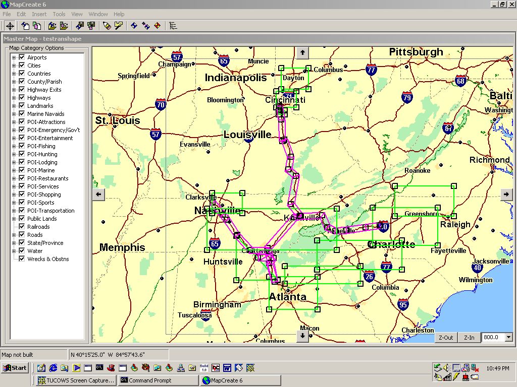
In the above example:
1) You place the mouse in the upper left corner where you want to
start a box, hold left mouse button down, move the mouse to
where you want the lower right corner of the box, release mouse button
and a box is formed enclosing your area of interest.
2) Multiple boxes are allowed and you can have the boxes overlap
and MC6 will eliminate the overlaps so redundant map data is not stored.
3) A feature allows the user to select "corridors" along roadways
(pink strips). The strips are formed by running the mouse along the
road line clicking the mouse button anywhere you want to make a turn and
thus create a strip with high map detail but just along a strip through
which the road runs.
4) The user can select which types of POIs are to be shown on the
map and uploaded to the GPS by checking options on the left of the map
shown above.
5) With MC6 and the MMC memory system used by iFinder, the
user can upload MULTIPLE map sections one at the time or all at once into
the MMC module.
6) MMC memory can also be erased all at once or in part and reloaded
with additional map sections without erasing all map sections.
7) It is not possible to load the MMC within the iFinder via the
serial port. TheUSB interface MMC reader/writer must be used for
all map and data upload/download.