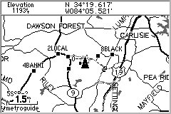
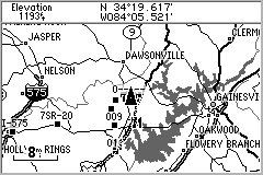
SCREEN DUMPS from StreetPilot GPS showing the rural area around Joe's Home about 40 Miles North of Atlanta
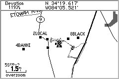 Dotted
lines are TRACKS. Black squares are waypoints uploaded from SA5.
Dotted
lines are TRACKS. Black squares are waypoints uploaded from SA5.
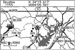
WITHOUT Atlanta Map Cartridge
 Atlanta
Map Cartridge Detail extends in a rectangle about 125 miles x 100 miles.
Atlanta
Map Cartridge Detail extends in a rectangle about 125 miles x 100 miles.
WITH Atlanta Metro Map Cartridge
 Above
the 8 mile scale, there is little extra detail with the Map Cartridge.
Above
the 8 mile scale, there is little extra detail with the Map Cartridge.
With Atlanta Metro Cartridge
Note straight horizontal LINE at top showing Cartridge Extent
 (This
is the BASE Map)
(This
is the BASE Map)
Without Atlanta Metro Cartridge
 ALL
Residential and Commercial Streets are Shown
ALL
Residential and Commercial Streets are Shown
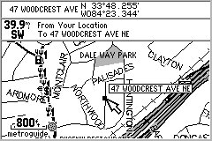
Downtown Atlanta WITH Map Cartridge
 Just
the main Roads and Expressways are Shown
Just
the main Roads and Expressways are Shown
Downtown Atlanta WITHOUT Map Cartridge
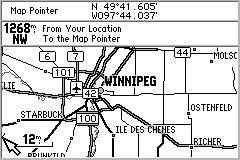
Canadian Base Maps are about the same as USA Base Maps.
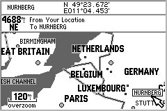
StreetPilot has rudimentary maps of the world included.
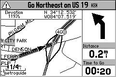
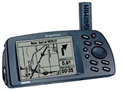
Route Guidance Screen with typical "turn coming up" display preceded
by "beep-beep" from SP
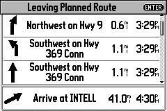
The Route Guide page gives details of the CURRENT route you are driving
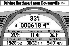
A "Dash Board" screen gives numeric information about your journey.
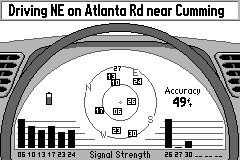
The Satellite screen gives info on which SVs are being tracked, signal
strengths, battery condition and EPE.
LE
FastCounter
Since June 19, 1998